
Halfmile’s Pacific Crest Trail maps have been updated for 2015 and they include cool new elevation profiles created by programmer Tom “66” Reid.
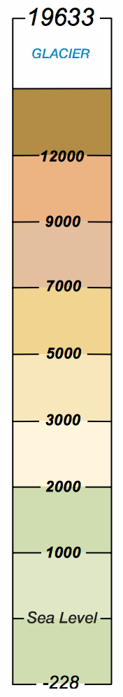
Colors used on FAA charts.
The new elevation profiles feature color coding in the style of FAA Aeronautical Charts, improved formatting to show more waypoints, and mileage that matches the 2015 Halfmile PCT mileage estimates.
Information on the elevation profiles includes:
- Page numbers to identify which PCT map pages are covered.
- Black dots for every half mile of trail.
- Red dots marking individual waypoints along the PCT.
- PCT mileage from the Mexican border every two miles.
- Elevation gain/loss is estimated (see the red circle above) for every two mile section of PCT.
The new elevation profiles are included with each section of PCT maps, or just the new elevation profiles for California can be downloaded here, or Oregon/Washington profiles can be downloaded here. Since PCT mileage estimates have changed for 2015, be sure not to mix and match 2014 and 2015 version of PCT maps, apps, or GPS data.
